![](/images/other/stat-length.png)
![Excursión A pie San Cristóbal de La Laguna - ES-SL-TG 01 Tegueste-Bajamar - Photo](https://media.geolcdn.com/t/1900/400/65f44273-f2cc-400e-98ab-6e6e24660cd8.jpeg&format=pjpeg&maxdim=2)
ES-SL-TG 01 Tegueste-Bajamar
SityTrail - itinéraires balisés pédestres
Tous les sentiers balisés d’Europe GUIDE+
![Longitud](/images/other/stat-length.png)
Longitud
8,9 km
![Altitud máxima](https://static1.geolcdn.com/siteimages/upload/files/1508320355ic_sort_altitude_max_24dp.png)
Altitud máxima
706 m
![Desnivel positivo](https://static1.geolcdn.com/siteimages/upload/files/1508320355ic_sort_den_pos_24dp.png)
Desnivel positivo
810 m
![Km-Effort](/images/other/stat-length.png)
Km-Effort
17,5 km
![Altitud mínima](https://static1.geolcdn.com/siteimages/upload/files/1508320355ic_sort_altitude_min_24dp.png)
Altitud mínima
45 m
![Desnivel negativo](https://static1.geolcdn.com/siteimages/upload/files/1508320355ic_sort_den_neg_24dp.png)
Desnivel negativo
152 m
![Boucle](https://static1.geolcdn.com/siteimages/upload/files/16400158638029165_repeat_loop_refresh_sync_direction_icon.png)
Boucle
No
Baliza
Fecha de creación :
2022-02-14 14:37:22.959
Última modificación :
2022-02-14 14:37:22.959
![A pie](https://static1.geolcdn.com/sitytour/trail-icons/100.png)
3h59
Dificultad : Fácil
![Escanee este código QR para abrir la excursión en la aplicación SityTrail](https://capi.geolives.com/qq0zvz2zws4bq2lad0pu/sitytour/trails/3108963/qr.png?size=200)
Aplicación GPS de excursión GRATIS
A propósito
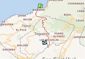
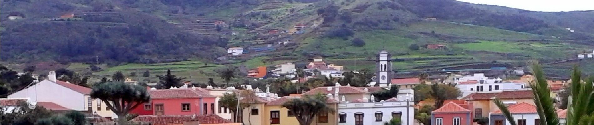
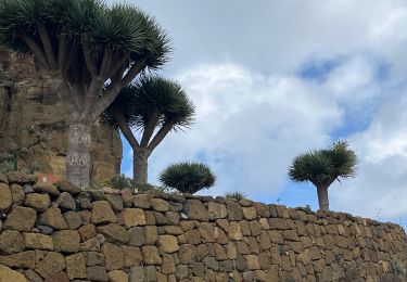
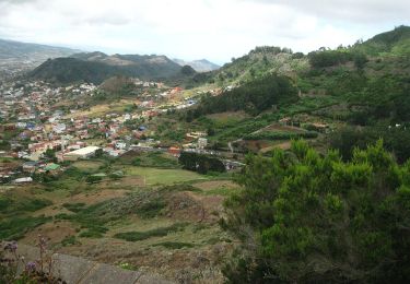
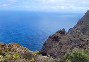
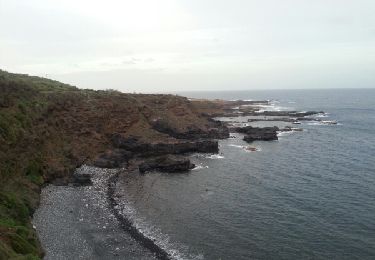
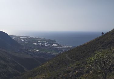
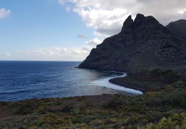
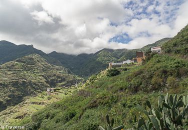
Ruta A pie de 8,9 km a descubrir en Canarias, Santa Cruz de Tenerife, San Cristóbal de La Laguna. Esta ruta ha sido propuesta por SityTrail - itinéraires balisés pédestres.
Descripción
Trail created by Ayuntamiento de Tegueste.
Symbol: parallel horizontal bars green white
Localización
País:
Spain
Región :
Canarias
Departamento/provincia :
Santa Cruz de Tenerife
Municipio :
San Cristóbal de La Laguna
Localidad:
Unknown
Salida:(Dec)
Salida:(UTM)
368176 ; 3159079 (28R) N.
Comentarios
Excursiones cerca
![Excursión Senderismo San Cristóbal de La Laguna - Massif de l'Anaga El Batan Chinamada - Photo](https://media.geolcdn.com/t/375/260/bf287400-cf63-4351-bbc9-dbe9aba0fa64.jpg&format=jpg&maxdim=2)
![Senderismo Senderismo](https://static1.geolcdn.com/sitytour/trail-icons/101.png)
Massif de l'Anaga El Batan Chinamada
Senderismo
Muy difícil
San Cristóbal de La Laguna,
Canarias,
Santa Cruz de Tenerife,
Spain
![](/images/other/stat-length.png)
10,8 km | 21 km-effort
4h 45min
![](https://static1.geolcdn.com/siteimages/upload/files/16400158638029165_repeat_loop_refresh_sync_direction_icon.png)
Sí
![Excursión A pie Tegueste - SL-TG 03 Las Canteras-Las Toscas - Photo](https://media.geolcdn.com/t/375/260/9b02a4e1-6549-4943-9eb8-9ef13f2363ff.jpeg&format=jpg&maxdim=2)
![A pie A pie](https://static1.geolcdn.com/sitytour/trail-icons/100.png)
SL-TG 03 Las Canteras-Las Toscas
A pie
Fácil
Tegueste,
Canarias,
Santa Cruz de Tenerife,
Spain
![](/images/other/stat-length.png)
6,4 km | 9,8 km-effort
2h 13min
![](https://static1.geolcdn.com/siteimages/upload/files/16400158638029165_repeat_loop_refresh_sync_direction_icon.png)
No
![Excursión Senderismo San Cristóbal de La Laguna - Punta del Hidalgo - Chinamada - Photo](https://media.geolcdn.com/t/375/260/2c9fb02f-c984-4854-86fb-fc5721d63a53.jpg&format=jpg&maxdim=2)
![Senderismo Senderismo](https://static1.geolcdn.com/sitytour/trail-icons/101.png)
Punta del Hidalgo - Chinamada
Senderismo
Medio
San Cristóbal de La Laguna,
Canarias,
Santa Cruz de Tenerife,
Spain
![](/images/other/stat-length.png)
10,9 km | 20 km-effort
3h 30min
![](https://static1.geolcdn.com/siteimages/upload/files/16400158638029165_repeat_loop_refresh_sync_direction_icon.png)
Sí
![Excursión Senderismo San Cristóbal de La Laguna - Punta de Hidalgo - Batan de Abajo - Photo](https://media.geolcdn.com/t/375/260/ext.jpg?maxdim=2&url=https%3A%2F%2Fservices.sitytrail.com%2FGeolivesWS%2FDownloadMedia.ashx%3FTrailID%3D384279%26Media%3Dfix__20150101180529.jpg)
![Senderismo Senderismo](https://static1.geolcdn.com/sitytour/trail-icons/101.png)
Punta de Hidalgo - Batan de Abajo
Senderismo
Muy fácil
San Cristóbal de La Laguna,
Canarias,
Santa Cruz de Tenerife,
Spain
![](/images/other/stat-length.png)
14,4 km | 26 km-effort
5h 49min
![](https://static1.geolcdn.com/siteimages/upload/files/16400158638029165_repeat_loop_refresh_sync_direction_icon.png)
Sí
![Excursión Senderismo Tegueste - Cruz del Carmen - Bajamar PR-TF12 - Photo](https://media.geolcdn.com/t/375/260/869fb28d-8541-4ec9-95a5-44120c6d68b4.jpg&format=jpg&maxdim=2)
![Senderismo Senderismo](https://static1.geolcdn.com/sitytour/trail-icons/101.png)
Cruz del Carmen - Bajamar PR-TF12
Senderismo
Difícil
Tegueste,
Canarias,
Santa Cruz de Tenerife,
Spain
![](/images/other/stat-length.png)
9,3 km | 12,8 km-effort
4h 44min
![](https://static1.geolcdn.com/siteimages/upload/files/16400158638029165_repeat_loop_refresh_sync_direction_icon.png)
No
![Excursión Ruta San Cristóbal de La Laguna - Punta del Hidalgo - Chinamada - Punta del Hidalgo - Photo](https://media.geolcdn.com/t/375/260/df56ef73-344d-41d5-ab0c-5df3b70d2416.jpg&format=jpg&maxdim=2)
![Ruta Ruta](https://static1.geolcdn.com/sitytour/trail-icons/104.png)
Punta del Hidalgo - Chinamada - Punta del Hidalgo
Ruta
Difícil
San Cristóbal de La Laguna,
Canarias,
Santa Cruz de Tenerife,
Spain
![](/images/other/stat-length.png)
10,8 km | 20 km-effort
4h 11min
![](https://static1.geolcdn.com/siteimages/upload/files/16400158638029165_repeat_loop_refresh_sync_direction_icon.png)
Sí
![Excursión Senderismo San Cristóbal de La Laguna - Mirador Aguaide - Photo](https://media.geolcdn.com/t/375/260/ext.jpg?maxdim=2&url=https%3A%2F%2Fservices.sitytrail.com%2FGeolivesWS%2FDownloadMedia.ashx%3FTrailID%3D853531%26Media%3Dfix__20171024135641.jpg)
![Senderismo Senderismo](https://static1.geolcdn.com/sitytour/trail-icons/101.png)
Mirador Aguaide
Senderismo
Difícil
San Cristóbal de La Laguna,
Canarias,
Santa Cruz de Tenerife,
Spain
![](/images/other/stat-length.png)
10,5 km | 20 km-effort
4h 0min
![](https://static1.geolcdn.com/siteimages/upload/files/16400158638029165_repeat_loop_refresh_sync_direction_icon.png)
Sí
![Excursión Senderismo Tegueste - Ballade Tegueste - Photo](https://media.geolcdn.com/t/375/260/ext.jpg?maxdim=2&url=https%3A%2F%2Fstatic1.geolcdn.com%2Fsiteimages%2Fupload%2Ffiles%2F1553511878bg_sport_marche.png)
![Senderismo Senderismo](https://static1.geolcdn.com/sitytour/trail-icons/101.png)
Ballade Tegueste
Senderismo
Medio
Tegueste,
Canarias,
Santa Cruz de Tenerife,
Spain
![](/images/other/stat-length.png)
10,5 km | 20 km-effort
2h 51min
![](https://static1.geolcdn.com/siteimages/upload/files/16400158638029165_repeat_loop_refresh_sync_direction_icon.png)
Sí
![Excursión Senderismo San Cristóbal de La Laguna - Los Platanes Saint Cristobal de La Laguna - Photo](https://media.geolcdn.com/t/375/260/85fd00fc-b517-4bd8-bcae-2d7a7a37d134.jpg&format=jpg&maxdim=2)
![Senderismo Senderismo](https://static1.geolcdn.com/sitytour/trail-icons/101.png)
Los Platanes Saint Cristobal de La Laguna
Senderismo
Difícil
San Cristóbal de La Laguna,
Canarias,
Santa Cruz de Tenerife,
Spain
![](/images/other/stat-length.png)
12,7 km | 22 km-effort
5h 44min
![](https://static1.geolcdn.com/siteimages/upload/files/16400158638029165_repeat_loop_refresh_sync_direction_icon.png)
Sí